GPS stands for Global Positioning System and is a satellite-based navigation system that provides location and time information in all weather conditions to users around the world. It is the most accurate navigation system available and can pinpoint your location within a few feet.
Did you know that GPS has been around for over 30 years? It was first developed by the military to help them track their planes and tanks. Here are 16 interesting facts about GPS that you may not have known:
- After the cold war, the US military realized they needed a way to navigate globally. So, they developed a system called GPS. It was initially used for military purposes.
- The launch of the first GPS satellite, OPS 5111, in 1978 was a major milestone in the development of the Global Positioning System. Also known as Navstar 1, NDS-1, GPS I-1, and GPS SVN-1, it was one of eleven Block I demonstration satellites.
- Nine out of the planned ten Navstar satellites were successfully launched into orbit. Unfortunately, one of the satellites was destroyed during the launch process.
- The idea for GPS came from two navigation systems used during WWII called LORAN and Decca. These systems helped ships and planes travel long distances by providing accurate location information. GPS was created based on their success.
- The Doppler Effect is an important part of how GPS works. It has to do with the way signals from GPS satellites change as they travel to Earth. By measuring these changes, GPS can figure out where something is located.
- As anyone who frequently travels by airplane knows, a GPS unit is an essential tool for navigation. Whether you’re trying to find your way to the airport or locate a specific building once you’ve landed, a GPS can be a lifesaver. However, there’s one thing that your GPS unit is afraid of being used in an intercontinental ballistic missile (ICBM) like application. If your GPS unit detects that it is traveling faster than 1200mph at an altitude higher than 60,000ft, it will automatically shut itself down. While this may seem like a strange safety measure, it’s actually designed to prevent the GPS unit from being used in a military application.
- It’s been reported that GPS signals in some areas of Moscow are being spoofed. This means that the signal is being redirected to a different location, in this case, Vnukovo Airport, which is 32 km away from the Kremlin. The fake signal causes anyone nearby to be located at the airport instead. It’s believed that this started happening when people began playing Pokemon Go. The problem only became apparent when people tried to use the game in Moscow. GPS spoofing is a serious issue because it can be used to disrupt services or mislead people. There have been other reports of GPS spoofing in other parts of the world, but this is the first time it’s been reported in Moscow.
- In 2013, Google acquired Waze for a whopping $1.1 billion, which made a significant impact on the GPS app industry. The 100 employees of Waze received a share of the sale, earning an average of $1.2 million each. Despite the high purchase price, Google has managed to make the investment worthwhile through the success of Waze. The app has consistently ranked among the top GPS apps available and has been downloaded millions of times. As a result, the employees who participated in the sale are now enjoying substantial financial rewards.
- Before May 2000, only the military could use the best GPS signals. These signals were very accurate and useful for navigation. But now, anyone with a GPS device can use these high-quality signals. It’s a helpful tool for finding your way around!
- Australia is a country that is always on the move. Literally. Due to the shifting of the Earth’s crust, Australia has moved so far since GPS coordinates were last updated in 1994 that they now need to shift all coordinates by 1.8 meters to be accurate enough for automated vehicles. This may not sound like much, but when you consider that GPS coordinates are used to guide everything from missiles to Mars rovers, it’s clear that this is a significant shift. Fortunately, Australia is not alone in this; many other countries are also in the process of updating their GPS coordinates. As we become increasingly reliant on automation and technology, it’s clear that we’ll need to be more vigilant about keeping our maps and coordinates up-to-date.
- The U.S. Global Positioning System (GPS) is a satellite-based navigation system that provides accurate location and time information in all weather conditions, anywhere on or near the Earth’s surface. The system is funded by the U.S. government. GPS service is provided free of charge to users worldwide, 24 hours a day, 7 days a week. While the service is free for users, it comes at a cost to U.S. taxpayers. The system costs approximately $2 million a day to operate and maintain. In addition, the system requires significant investment to keep it running smoothly and efficiently. Despite the high cost, the GPS system provides an invaluable service to people around the world and is considered one of the most important pieces of infrastructure in the 21st century.
- GPS technology was first made available in cars in the year 1996. Before GPS, people had to rely on maps or ask for directions from others.
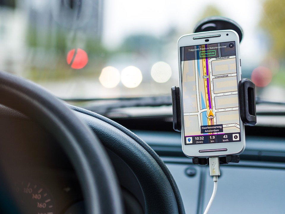
- One of the most popular uses for smartphones is navigation. When GPS was first introduced as a built-in feature in cars, it was heralded as a game-changer. Finally, we would be able to say goodbye to fumbling with fold-out maps and getting lost! However, it didn’t take long for people to realize that their phones were just as good at giving directions, if not better. After all, phones are updated more frequently than car GPS systems, and they offer features like live traffic updates and rerouting that can save you time and frustration. So while GPS systems may still have a place in our cars, it seems that most of us would rather rely on our trusty smartphones when it comes to getting around town.
- While GPS is most commonly associated with car navigation, it has a wide range of other uses, from tracking wildlife to guiding missiles. One important but often overlooked use for GPS is obtaining accurate time. Most Time and Frequency Standards Laboratories, which are responsible for maintaining the world’s official time, now rely on GPS signals to keep their clocks synchronized. GPS satellites are equipped with extremely precise atomic clocks, and by tracking the signals from multiple satellites, it is possible to determine the time with an accuracy of a few nanoseconds.
- During the late 1990s, BMW decided to recall the GPS system in their 5 Series cars. This was because many male drivers were not comfortable taking directions from the female voice that was built into the system. This issue was causing inconvenience and discomfort for some drivers, which is why BMW decided to take action.
- Galileo is a navigation system developed by the European Union and the European Space Agency. It is designed to provide an alternative to GPS and offers highly accurate location data, with an accuracy of just one meter.